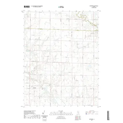
2021 Map of Enterprise
USGS Topo · Published 2021About this map
The tiny settlement of Enterprise is positioned near the junction of Co HWY 1 and Co RD 1850 N, serving as a central point in this southern Illinois landscape. The geography is defined by the winding course of the Little Wabash River in the northeast and the Elm River in the west, which flows toward the Elm River Drainage Ditch. This drainage network reflects the agricultural development of the region, where numerous family and community burial sites are scattered across the townships. Genealogists will find a high concentration of cemeteries, including Evangelical Cem, Zif Cem, Wells Cem, and Williams Cem, many located at rural crossroads. The map also delineates the administrative borders between Clay, Wayne, and Richland counties, illustrating how these local boundaries intersect with the natural path of the river systems.
Find a feature on this map
60 named features on this map. Tap any name to fly to it.
Don’t see what you’re looking for? This feature index may not catch every label — zoom into the map to look around manually.
Map Details
Editions of this 2021 Enterprise Map
This is the sole edition of this map. No revisions or reprints were ever made.
Other maps of this area

1943 · Albion
USGS Topo · 1:62,500

1946 · Albion
USGS Topo · 1:62,500

1948 · Fairfield
USGS Topo · 1:62,500

1948 · Flora
USGS Topo · 1:62,500

1949 · Olney
USGS Topo · 1:62,500

1949 · Flora
USGS Topo · 1:62,500

1958 · Belleville
USGS Topo · 1:250,000

1962 · Belleville
USGS Topo · 1:250,000

1970 · Clay City
USGS Topo · 1:24,000

1970 · Enterprise
USGS Topo · 1:24,000