1932 Map of Epes
USGS Topo · Published 1948About this map
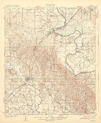
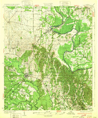
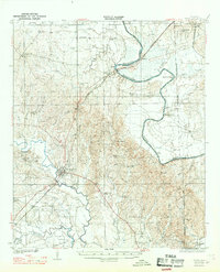
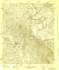
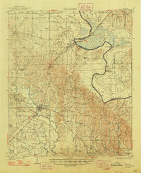
Livingston and the surrounding riverlands of the West Alabama Black Belt appear here as they were surveyed in the late 1920s. The landscape is defined by the winding course of the Tombigbee River, which forms the boundary between Sumter and Greene counties, and its confluence with the Sucarnoochee River. This era shows a transition in river transport, where older river crossings like Hillman Ferry and landmarks such as Jones Bluff and Traggs Bluff still guided local travel along the water. In town, the Industrial School stands as a significant landmark of education during the Jim Crow era.
Find a feature on this map
54 named features on this map. Tap any name to fly to it.
Don’t see what you’re looking for? This feature index may not catch every label — zoom into the map to look around manually.
Map Details
Editions of this 1932 Epes Map
4 editions found