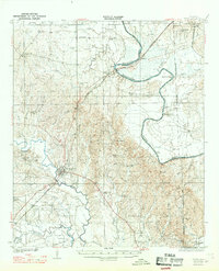
1932 Map of Epes
USGS Topo · Published 1969About this map
The Tombigbee River forms a winding corridor through the heart of this West Alabama landscape, serving as the primary natural divide between Sumter and Greene Counties. On the western bluffs, the town of Livingston stands as a significant hub, anchored by the Industrial School and the convergence of the Southern railway. The river's influence is clear at McAlpin Bend and Traggs Bluff, where the topography rises sharply from the water's edge.
Find a feature on this map
58 named features on this map. Tap any name to fly to it.
Don’t see what you’re looking for? This feature index may not catch every label — zoom into the map to look around manually.
Map Details
Editions of this 1932 Epes Map
4 editions found

Other maps of this area

1927 · Eutaw
USGS Topo · 1:48,000

1929 · Epes
USGS Topo · 1:48,000

1931 · Eutaw
USGS Topo · 1:62,500

1932 · Epes
USGS Topo · 1:62,500

1947 · Forkland
USGS Topo · 1:24,000

1948 · Mc Dowell
USGS Topo · 1:24,000

1949 · Mc Dowell
USGS Topo · 1:24,000

1949 · Forkland
USGS Topo · 1:24,000

1953 · Montgomery
USGS Topo · 1:250,000

1953 · Meridian
USGS Topo · 1:250,000