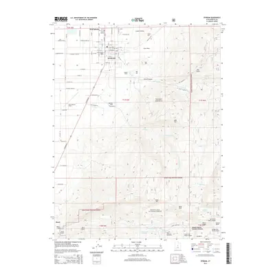
2014 Map of Ephraim
USGS Topo · Published 2014About this map
Ephraim and the northern edge of Manti anchor this Sanpete County landscape, where the transition from valley floor to the high plateau of the Manti-LaSal National Forest is clearly defined. The city of Ephraim is the institutional hub of the area, home to Snow Coll and the Sanpete District Ranger Office, while the surrounding grid includes West Ephraim and the Ephraim Park Cem.
Find a feature on this map
60 named features on this map. Tap any name to fly to it.
Don’t see what you’re looking for? This feature index may not catch every label — zoom into the map to look around manually.
Map Details
Editions of this 2014 Ephraim Map
This is the sole edition of this map. No revisions or reprints were ever made.
Other maps of this area

1885 · Manti
USGS Topo · 1:250,000

1895 · Manti
USGS Topo · 1:250,000

1922 · Wasatch
USGS Topo · 1:31,680

1956 · Price
USGS Topo · 1:250,000

1960 · Price
USGS Topo · 1:250,000

1962 · Price
USGS Topo · 1:250,000

1965 · Manti
USGS Topo · 1:24,000

1965 · Wales
USGS Topo · 1:24,000

1965 · Black Mountain
USGS Topo · 1:24,000
1966 · Ferron Reservoir
USGS Topo · 1:24,000