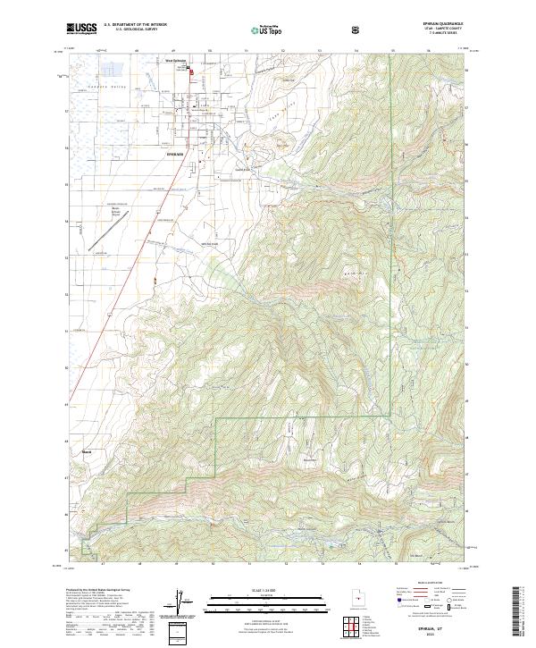
2023 Map of Ephraim
USGS Topo · Published 2023About this map
Ephraim serves as the primary hub of this area, sitting at the base of the mountain ranges within the Sanpete Valley. The map documents a classic Utah settlement pattern where structured town grids, such as those near Snow College and the Ephraim Park Cemetery, give way to an intricate system of water management. A network of irrigation features including Larsen Ditch, Gablefield Ditch, and Cane Valley Ditch underscores the region's reliance on mountain runoff for agriculture.
Find a feature on this map
71 named features on this map. Tap any name to fly to it.
Don’t see what you’re looking for? This feature index may not catch every label — zoom into the map to look around manually.
Map Details
Editions of this 2023 Ephraim Map
This is the sole edition of this map. No revisions or reprints were ever made.
Other maps of this area

1885 · Manti
USGS Topo · 1:250,000

1895 · Manti
USGS Topo · 1:250,000

1922 · Wasatch
USGS Topo · 1:31,680

1956 · Price
USGS Topo · 1:250,000

1960 · Price
USGS Topo · 1:250,000

1962 · Price
USGS Topo · 1:250,000

1965 · Manti
USGS Topo · 1:24,000

1965 · Wales
USGS Topo · 1:24,000

1965 · Black Mountain
USGS Topo · 1:24,000
1966 · Ferron Reservoir
USGS Topo · 1:24,000