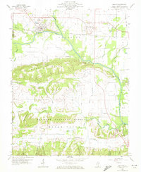
1959 Map of Equality
USGS Topo · Published 1972About this map
The North Fork Saline River defines the northern lowlands of this Illinois survey, where the town of Equality sits at the junction of road and rail. The landscape is sharply divided between the river valley and the rising Wildcat Hills, a heavily wooded terrain that transitions into the Shawnee National Forest. Industrial activity is evident in the multiple mines, including the Wildcat Mine and several unidentified mines and strip mines that follow the coal seams of the region.
Find a feature on this map
52 named features on this map. Tap any name to fly to it.
Don’t see what you’re looking for? This feature index may not catch every label — zoom into the map to look around manually.
Map Details
Editions of this 1959 Equality Map
3 editions found
Other maps of this area

1905 · Eldorado
USGS Topo · 1:62,500

1905 · New Haven
USGS Topo · 1:62,500

1906 · New Haven
USGS Topo · 1:62,500

1906 · Eldorado
USGS Topo · 1:62,500

1916 · Shawneetown
USGS Topo · 1:62,500

1916 · Equality
USGS Topo · 1:62,500

1949 · Paducah
USGS Topo · 1:250,000

1949 · New Haven
USGS Topo · 1:62,500

1950 · Paducah
USGS Topo · 1:250,000

1954 · Paducah
USGS Topo · 1:250,000