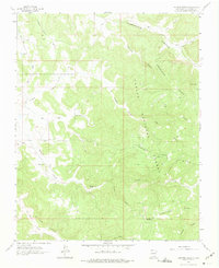
1963 Map of Espinosa Ranch
USGS Topo · Published 1975About this map
Espinosa Ranch stands as the primary human landmark in this section of the Carson National Forest, where high plateau terrain and deep drainage systems define the Rio Arriba landscape. Mapped in the early 1960s, the area exhibits a transition toward energy extraction, evidenced by numerous Gas Wells and a Pipeline cutting across the mesas. The topography is dominated by extensive flat-topped features like American Mesa and Cabresto Mesa, which are dissected by an intricate network of named canyons including La Fragua Canyon and American Canyon. Water sources are sparse but critical in this environment, represented by Manuel Spring and the ephemeral Laguna Seca. The presence of several Trails and Jeep Trails suggests a landscape utilized for ranching, forest management, and resource exploration during this era.
Find a feature on this map
32 named features on this map. Tap any name to fly to it.
Don’t see what you’re looking for? This feature index may not catch every label — zoom into the map to look around manually.
Map Details
Editions of this 1963 Espinosa Ranch Map
4 editions found
Other maps of this area

1889 · Largo
USGS Topo · 1:250,000

1895 · Largo
USGS Topo · 1:250,000

1954 · Rosa
USGS Topo · 1:24,000

1954 · Gomez Ranch
USGS Topo · 1:24,000

1954 · Aztec
USGS Topo · 1:250,000

1958 · Aztec
USGS Topo · 1:250,000

1962 · Aztec
USGS Topo · 1:250,000

1963 · Fourmile Canyon
USGS Topo · 1:24,000
1963 · Espinosa Ranch
USGS Topo · 1:24,000

1963 · Gobernador
USGS Topo · 1:24,000