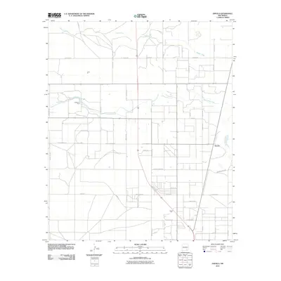
2010 Map of Espuela
USGS Topo · Published 2010About this map
Walnut Creek and Cottonwood Creek dictate the landscape of this high desert terrain in southeastern New Mexico, where water management and industrial extraction shape the local economy. The settlement of Espuela sits along the eastern edge of a grid-dominated rural layout, connected by a network of ranch and county roads. Infrastructure such as O'Bannon Dam indicates the critical role of surface water control in an area otherwise defined by aridity and expansive ranching operations.
Find a feature on this map
40 named features on this map. Tap any name to fly to it.
Don’t see what you’re looking for? This feature index may not catch every label — zoom into the map to look around manually.
Map Details
Editions of this 2010 Espuela Map
This is the sole edition of this map. No revisions or reprints were ever made.
Other maps of this area

1951 · Hagerman
USGS Topo · 1:24,000

1952 · Hagerman SW
USGS Topo · 1:24,000

1953 · Espuela
USGS Topo · 1:24,000

1954 · Carlsbad
USGS Topo · 1:250,000

1955 · Artesia
USGS Topo · 1:24,000

1955 · Artesia NE
USGS Topo · 1:24,000

1955 · Spring Lake
USGS Topo · 1:24,000

1955 · Hackberry Ranch
USGS Topo · 1:24,000

1955 · Hope NE
USGS Topo · 1:24,000

1955 · Roswell
USGS Topo · 1:250,000