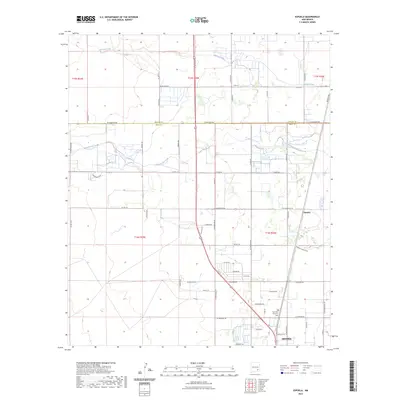
2023 Map of Espuela
USGS Topo · Published 2023About this map
Artesia anchors the southern boundary of this high-plains landscape, where the northern expansion of the city meets the agricultural and desert lands of the Pecos Valley. The terrain is defined by the ephemeral courses of Cottonwood Creek and Walnut Creek, which cut eastward through the township and range grid. This survey highlights the rural-to-urban transition, showing a dense network of local roads such as W Compress Rd and E Cottonwood Rd that serve the outlying residential and industrial sections. Near the northeastern corner, the small settlement of Espuela sits along the roadway, while landmarks like the Twin Oaks Memorial Park provide specific points of interest for local researchers. The map clearly delineates the border between Chaves County and Eddy County, illustrating the jurisdictional divide in this region of southeastern New Mexico.
Find a feature on this map
61 named features on this map. Tap any name to fly to it.
Don’t see what you’re looking for? This feature index may not catch every label — zoom into the map to look around manually.
Map Details
Editions of this 2023 Espuela Map
This is the sole edition of this map. No revisions or reprints were ever made.
Other maps of this area

1951 · Hagerman
USGS Topo · 1:24,000

1952 · Hagerman SW
USGS Topo · 1:24,000

1953 · Espuela
USGS Topo · 1:24,000

1954 · Carlsbad
USGS Topo · 1:250,000

1955 · Artesia
USGS Topo · 1:24,000

1955 · Artesia NE
USGS Topo · 1:24,000

1955 · Spring Lake
USGS Topo · 1:24,000

1955 · Hackberry Ranch
USGS Topo · 1:24,000

1955 · Hope NE
USGS Topo · 1:24,000

1955 · Roswell
USGS Topo · 1:250,000