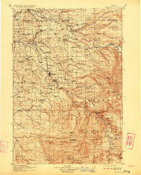
1916 Map of Estacada
USGS Topo · Published 1923About this map
The Portland Railway Light & Power Co line dictates the industrial corridor of the early 20th century, stretching southeast through Boring toward the hydroelectric developments at River Mill and Cazadero. Along the Clackamas River, the infrastructure of early power generation is evident at the Upper Dam, while the northern reaches show the critical Intake Portland Waterworks within the Bull Run National Forest. These features highlight the region's role as a vital resource hub for the growing metropolitan area nearby.
Find a feature on this map
161 named features on this map. Tap any name to fly to it.
Don’t see what you’re looking for? This feature index may not catch every label — zoom into the map to look around manually.
Map Details
Editions of this 1916 Estacada Map
5 editions found
Other maps of this area

1897 · Portland
USGS Topo · 1:62,500

1905 · Portland
USGS Topo · 1:62,500

1911 · Boring
USGS Topo · 1:48,000

1914 · Boring
USGS Topo · 1:62,500

1914 · Oregon City
USGS Topo · 1:62,500

1916 · Estacada
USGS Topo · 1:125,000

1918 · Troutdale
USGS Topo · 1:62,500

1924 · Mount Hood
USGS Topo · 1:125,000

1926 · Hood River
USGS Topo · 1:125,000

1927 · Mount Hood
USGS Topo · 1:125,000