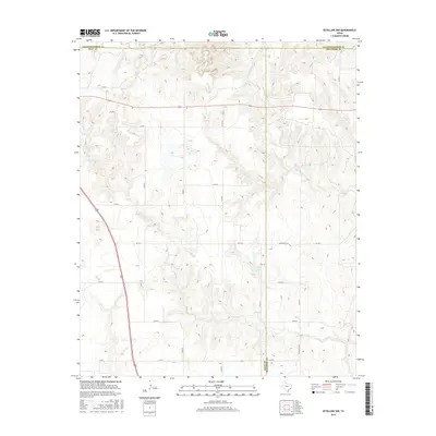
2016 Map of Estelline NW
USGS Topo · Published 2016About this map
Helms Lake lies near the intersection of several rural routes in this section of the Texas Panhandle, where the borders of Hall, Collingsworth, and Childress counties meet. The landscape is defined by the intermittent drainage of Jonah Cr and Dry Salt Cr, which carve a complex network of draws across the terrain. This 2016 survey illustrates the modern layout of the region's agricultural and ranching infrastructure, primarily served by a grid of county roads and FM 1619. The map provides a detailed view of the land parcels and property boundaries in this sparsely populated cattle and farming country, tracing the path of Ranch Rd 1619 as it winds through the topographic breaks east of the Hall county line.
Find a feature on this map
22 named features on this map. Tap any name to fly to it.
Don’t see what you’re looking for? This feature index may not catch every label — zoom into the map to look around manually.
Map Details
Editions of this 2016 Estelline NW Map
This is the sole edition of this map. No revisions or reprints were ever made.
Other maps of this area

1954 · Plainview
USGS Topo · 1:250,000

1958 · Plainview
USGS Topo · 1:250,000

1961 · Memphis
USGS Topo · 1:62,500

1961 · Estelline
USGS Topo · 1:62,500

1963 · Giles
USGS Topo · 1:24,000

1964 · Rolla SW
USGS Topo · 1:24,000

1964 · Rolla
USGS Topo · 1:24,000

1976 · Memphis SE
USGS Topo · 1:24,000

1976 · Memphis NE
USGS Topo · 1:24,000

1984 · Estelline NE
USGS Topo · 1:24,000