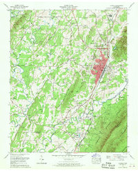
1967 Map of Etowah
USGS Topo · Published 1970About this map
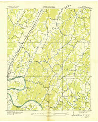
The Louisville and Nashville railroad corridor anchors this 1967 survey, defining the industrial and civic heart of Etowah. The town's grid is dense with mid-century infrastructure, including Woods Memorial Hospital, City Hall, and Etowah High School, while the surrounding landscape reveals a network of rural life tied to the terrain of The Knobs and Starr Mountain. Historical transportation routes like the Old Federal Road and Old Athens Road intersect the valley, connecting established settlements such as Delano, Cog Hill, and Piney Grove. Local genealogy is well-documented through numerous sites like Woodlawn Cem and Old Salem Cem, alongside country congregations such as New Salem Ch. The transition from the developed valley to the Cherokee National Forest illustrates the varied land use between timber, agriculture at Delano Mill, and the leisure space of the Chestnut Golf and Country Club.
Find a feature on this map
85 named features on this map. Tap any name to fly to it.
Don’t see what you’re looking for? This feature index may not catch every label — zoom into the map to look around manually.
Map Details
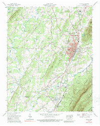
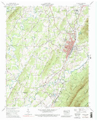
Editions of this 1967 Etowah Map
3 editions found
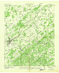
Other maps of this area

1886 · Cleveland
USGS Topo · 1:125,000

1892 · Cleveland
USGS Topo · 1:125,000

1893 · Murphy
USGS Topo · 1:125,000

1895 · Cleveland
USGS Topo · 1:125,000

1901 · Cleveland
USGS Topo · 1:125,000

1914 · Murphy
USGS Topo · 1:125,000

1934 · Mecca
USGS Topo · 1:24,000
1934 · Englewood
USGS Topo · 1:24,000

1935 · Tellico
USGS Topo · 1:48,000
1935 · Calhoun
USGS Topo · 1:24,000