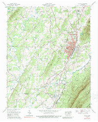
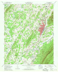
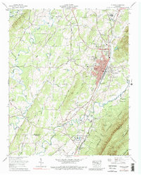
1967 Map of Etowah
USGS Topo · Published 1989About this map
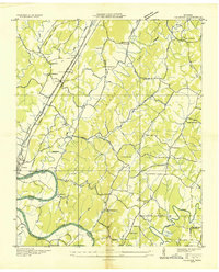
Louisville and Nashville tracks anchor the industrial heart of Etowah, a city shaped by its role as a rail hub between the valley and the mountains. This mid-century survey reveals a maturing landscape where the concentrated grid of the city, including Woods Memorial Hospital and the local Post Office, meets the sprawling boundary of the Cherokee National Forest. To the south, the Conasauga River winds toward the settlement of Delano, while the slopes of Starr Mountain rise sharply to the east, providing a dramatic backdrop to the valley's farmland.
Find a feature on this map
70 named features on this map. Tap any name to fly to it.
Don’t see what you’re looking for? This feature index may not catch every label — zoom into the map to look around manually.
Map Details
Editions of this 1967 Etowah Map
3 editions found
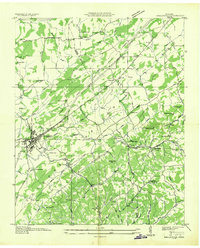
Other maps of this area

1886 · Cleveland
USGS Topo · 1:125,000

1892 · Cleveland
USGS Topo · 1:125,000

1893 · Murphy
USGS Topo · 1:125,000

1895 · Cleveland
USGS Topo · 1:125,000

1901 · Cleveland
USGS Topo · 1:125,000

1914 · Murphy
USGS Topo · 1:125,000

1934 · Mecca
USGS Topo · 1:24,000
1934 · Englewood
USGS Topo · 1:24,000

1935 · Tellico
USGS Topo · 1:48,000
1935 · Calhoun
USGS Topo · 1:24,000