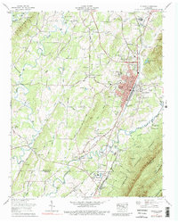
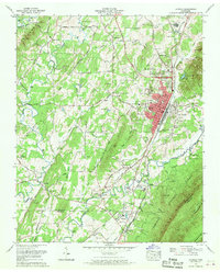
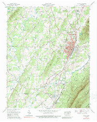
1967 Map of Etowah
USGS Topo · Published 1989About this map
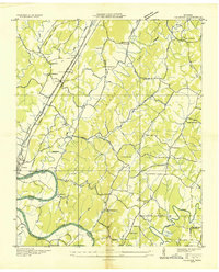
Etowah serves as a major hub for the Louisville and Nashville Railroad in the 1960s, with extensive yard infrastructure and the nearby L and N Reservoir indicating the industrial importance of the rail line to the region. The landscape transitions from the urban density of the city center to the rural settlements of North Etowah and East Etowah, eventually rising into the Cherokee National Forest and Starr Mountain to the southeast. Community institutions like Woods Memorial Hospital and the Etowah Jr High Sch are clearly marked, alongside various family-named landmarks such as Tom Foeman Hill. To the south, the Conasauga River meanders toward Delano, passing through a landscape dotted with numerous country churches and cemeteries like Old Salem Ch and Carlock Cem.
Find a feature on this map
77 named features on this map. Tap any name to fly to it.
Don’t see what you’re looking for? This feature index may not catch every label — zoom into the map to look around manually.
Map Details
Editions of this 1967 Etowah Map
3 editions found
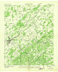
Other maps of this area

1886 · Cleveland
USGS Topo · 1:125,000

1892 · Cleveland
USGS Topo · 1:125,000

1893 · Murphy
USGS Topo · 1:125,000

1895 · Cleveland
USGS Topo · 1:125,000

1901 · Cleveland
USGS Topo · 1:125,000

1914 · Murphy
USGS Topo · 1:125,000

1934 · Mecca
USGS Topo · 1:24,000
1934 · Englewood
USGS Topo · 1:24,000

1935 · Tellico
USGS Topo · 1:48,000
1935 · Calhoun
USGS Topo · 1:24,000