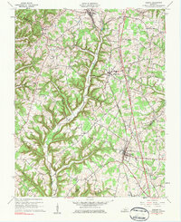
1961 Map of Eubank
USGS Topo · Published 1983About this map
Eubank and Waynesburg serve as central hubs in this corner of Kentucky, where the Southern railroad corridor dictates the placement of settlements and industry. The landscape transitions from the relatively flat rail-side towns into the dissected ridges of El Ridge and Pilot Ridge to the west. This 1961 revision, based on 1950s fieldwork, highlights a high density of rural institutions, including the Eubank Sch and numerous community landmarks like Phillips Chapel and Locust Grove Ch.
Find a feature on this map
41 named features on this map. Tap any name to fly to it.
Don’t see what you’re looking for? This feature index may not catch every label — zoom into the map to look around manually.
Map Details
Editions of this 1961 Eubank Map
2 editions found
Other maps of this area

1935 · Somerset
USGS Topo · 1:62,500

1952 · Halls Gap
USGS Topo · 1:24,000

1952 · Eubank
USGS Topo · 1:24,000

1952 · Crab Orchard
USGS Topo · 1:24,000

1952 · Hustonville
USGS Topo · 1:24,000

1952 · Yosemite
USGS Topo · 1:24,000

1952 · Woodstock
USGS Topo · 1:24,000

1953 · Mintonville
USGS Topo · 1:24,000
1954 · Bobtown
USGS Topo · 1:24,000

1954 · Science Hill
USGS Topo · 1:24,000