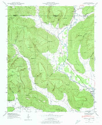
1947 Map of Eureka
USGS Topo · Published 1974About this map
John Sumach Reservation sits at the heart of this 1947 landscape, where the Tennessee-Alabama state line cuts across the highland terrain of Little Coon Mountain. The area is characterized by deep hollows and high points like Sumners Top, with small agricultural settlements and family stores such as Brisco Store and Bell Store serving the valley communities. The Nashville Chattanooga and St Louis railroad follows the course of Crow Creek, providing a vital transit link through the corridor toward the Guntersville Reservoir in the south.
Find a feature on this map
78 named features on this map. Tap any name to fly to it.
Don’t see what you’re looking for? This feature index may not catch every label — zoom into the map to look around manually.
Map Details
Editions of this 1947 Eureka Map
4 editions found
Other maps of this area

1886 · Stevenson
USGS Topo · 1:125,000

1888 · Scottsboro
USGS Topo · 1:125,000

1892 · Scottsboro
USGS Topo · 1:125,000

1892 · Stevenson
USGS Topo · 1:125,000

1895 · Stevenson
USGS Topo · 1:125,000

1895 · Sewanee
USGS Topo · 1:125,000

1928 · Decherd
USGS Topo · 1:62,500

1936 · Orme
USGS Topo · 1:24,000

1936 · Wannville
USGS Topo · 1:24,000

1936 · Sinking Cove
USGS Topo · 1:24,000