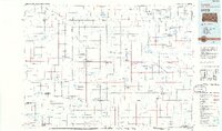
1985 Map of Eureka
USGS Topo · Published 1986About this map
Eureka serves as a central hub in this mid-1980s portrait of the North Dakota-South Dakota borderlands, where the High Plains are defined by an extensive network of waterfowl and game production areas. The landscape is dotted with small agricultural settlements like Zeeland, Hosmer, and Venturia, many linked by the steel of the Burlington Northern and Soo Line railroads. This era shows the region's heavy reliance on the land, with numerous state-managed conservation sites such as North Jackson State Game Production Area and Neuhart State Game Production Area protecting the prairie potholes and seasonal water bodies like Wolf Lake and Alkali Lake. South of the border, Lake Hiddenwood State Park provides a recreational anchor near the drainage of Hiddenwood Creek, while the Plainview Colony reflects the unique communal settlement patterns characteristic of the northern plains.
Find a feature on this map
59 named features on this map. Tap any name to fly to it.
Don’t see what you’re looking for? This feature index may not catch every label — zoom into the map to look around manually.
Map Details
Editions of this 1985 Eureka Map
3 editions found
Other maps of this area

1896 · Edgeley
USGS Topo · 1:125,000

1899 · Ellendale
USGS Topo · 1:125,000

1899 · Northville
USGS Topo · 1:125,000

1925 · Edgeley
USGS Topo · 1:125,000

1953 · Jamestown
USGS Topo · 1:250,000

1953 · McIntosh
USGS Topo · 1:250,000

1954 · Aberdeen
USGS Topo · 1:250,000

1954 · Bismarck
USGS Topo · 1:250,000

1956 · Aberdeen
USGS Topo · 1:250,000

1956 · Jamestown
USGS Topo · 1:250,000