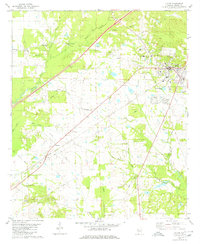
1980 Map of Eutaw
USGS Topo · Published 1980About this map
The Greene County seat of Eutaw sits at a geographic crossroads in the 1980s, where the Southern railroad line intersects with local commerce and education at the Middle Sch and Warrior Academy. The surrounding landscape is defined by the dense network of tributaries feeding into Brush Creek, including Pippen Branch and Moore Branch. This era shows a community deeply rooted in its local institutions, evidenced by the numerous small churches and family-named cemeteries scattered across the countryside.
Find a feature on this map
29 named features on this map. Tap any name to fly to it.
Don’t see what you’re looking for? This feature index may not catch every label — zoom into the map to look around manually.
Map Details
Editions of this 1980 Eutaw Map
2 editions found
Other maps of this area

1927 · Eutaw
USGS Topo · 1:48,000

1929 · Epes
USGS Topo · 1:48,000

1931 · Eutaw
USGS Topo · 1:62,500

1932 · Epes
USGS Topo · 1:62,500

1947 · Mason Bend
USGS Topo · 1:24,000

1947 · Forkland
USGS Topo · 1:24,000

1948 · Mason Bend
USGS Topo · 1:24,000

1949 · Forkland
USGS Topo · 1:24,000

1953 · Montgomery
USGS Topo · 1:250,000

1953 · Meridian
USGS Topo · 1:250,000