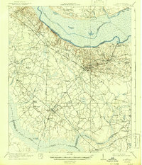
1921 Map of Eutawville
USGS Topo · Published 1942About this map
The Santee River corridor defines this South Carolina landscape, captured during the 1920s before the creation of modern reservoirs altered the region's hydrology. The survey details a rural economy centered on the Atlantic Coast Line railroad, which connects the primary settlements of Holly Hill and Eutawville. This period represents a significant era of local infrastructure, documented by numerous community landmarks such as Camden Road School, Springfield Church, and Liveoak Church.
Find a feature on this map
62 named features on this map. Tap any name to fly to it.
Don’t see what you’re looking for? This feature index may not catch every label — zoom into the map to look around manually.
Map Details
Editions of this 1921 Eutawville Map
3 editions found

Other maps of this area

1919 · Summerville
USGS Topo · 1:48,000

1919 · Ridgeville
USGS Topo · 1:48,000

1920 · Eutawville
USGS Topo · 1:48,000

1920 · Chicora
USGS Topo · 1:48,000

1920 · Bowman
USGS Topo · 1:48,000

1920 · Manning
USGS Topo · 1:48,000

1920 · Ridgeville
USGS Topo · 1:62,500

1920 · St. George
USGS Topo · 1:48,000

1920 · Summerville
USGS Topo · 1:62,500

1921 · Chicora
USGS Topo · 1:62,500