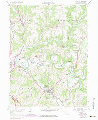
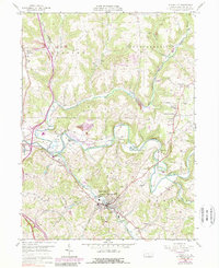
1958 Map of Evans City
USGS Topo · Published 1983About this map
Evans City and the neighboring borough of Harmony anchor this portrait of Butler County's industrial and agricultural landscape in the mid-20th century. The Baltimore and Ohio line threads through the valley of Connoquenessing Creek, connecting the active rail hub at Harmony Junction with smaller outposts like Buhls Sta and Watters. The map reveals a land transitioning from traditional farming to industrial extraction, evidenced by numerous Strip Mine operations and oil wells scattered across the hills near Wahlville and Middle Lancaster. Local social life is preserved through the locations of the Stamm Sch, Zion Ch, and the St Johns Ch in Petersville. Notable infrastructure including an Abandoned Tunnel near Watters and the Evans City Cemetery provides specific points of interest for local researchers and genealogists studying the evolution of these Pennsylvania townships.
Find a feature on this map
43 named features on this map. Tap any name to fly to it.
Don’t see what you’re looking for? This feature index may not catch every label — zoom into the map to look around manually.
Map Details
Editions of this 1958 Evans City Map
5 editions found
Other maps of this area

1906 · Sewickley
USGS Topo · 1:62,500

1908 · Sewickley
USGS Topo · 1:62,500

1908 · New Kensington
USGS Topo · 1:62,500

1908 · Zelienople
USGS Topo · 1:62,500

1909 · Butler
USGS Topo · 1:62,500

1910 · New Kensington
USGS Topo · 1:62,500

1910 · Zelienople
USGS Topo · 1:62,500

1911 · Butler
USGS Topo · 1:62,500

1950 · Valencia
USGS Topo · 1:24,000

1951 · Canton
USGS Topo · 1:250,000