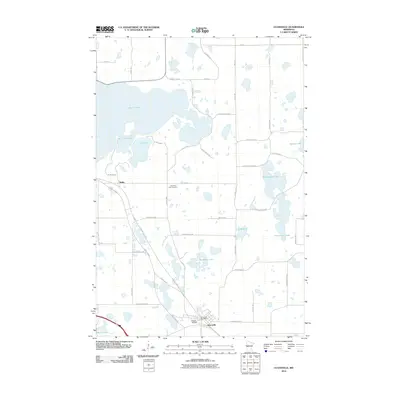
2010 Map of Evansville
USGS Topo · Published 2010About this map
Lake Christina dominates the northern landscape of this Douglas County region, anchoring a dense network of glacial basins and wetlands. The settlement of Evansville serves as the primary hub in the south, characterized by its local infrastructure including the Evansville Post Office and the nearby Elmer Airport. This area of Minnesota is defined by a complex hydrography where names like Stockhousen Lake, Stockhaven Lake, and Horseshoe Lake reflect a landscape shaped by water.
Find a feature on this map
47 named features on this map. Tap any name to fly to it.
Don’t see what you’re looking for? This feature index may not catch every label — zoom into the map to look around manually.
Map Details
Editions of this 2010 Evansville Map
This is the sole edition of this map. No revisions or reprints were ever made.
Other maps of this area

1911 · Barrett
USGS Topo · 1:62,500

1913 · Ashby
USGS Topo · 1:62,500

1953 · Brainerd
USGS Topo · 1:250,000

1953 · Saint Cloud
USGS Topo · 1:250,000

1957 · Brainerd
USGS Topo · 1:250,000

1957 · Saint Cloud
USGS Topo · 1:250,000

1958 · Saint Cloud
USGS Topo · 1:250,000

1958 · Brainerd
USGS Topo · 1:250,000

1965 · Brainerd
USGS Topo · 1:250,000

1966 · Brandon
USGS Topo · 1:24,000