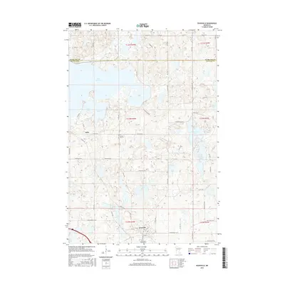
2016 Map of Evansville
USGS Topo · Published 2016About this map
Lake Christina dominates the northwest corner of this West-Central Minnesota landscape, where the glacial drift of Douglas and Otter Tail counties is marked by a high density of wetlands and basins. The settlement of Evansville is situated in the south, anchored by Railroad St and the Mound Grove Memorial Park. To the northwest, the small community of Melby sits near the shores of Lake Anka and Lake Ina. This area shows a transition from larger water bodies to a complex pattern of smaller, isolated wetlands like Horseshoe Lake and Stockhousen Lake. Local history is preserved at the Christina Lake Cem, which overlooks the landscape from its position between Melby and the northern lake system. The road network, including Co Hwy 64 and various township roads, reflects a rectilinear survey grid that navigates around the numerous water features.
Find a feature on this map
68 named features on this map. Tap any name to fly to it.
Don’t see what you’re looking for? This feature index may not catch every label — zoom into the map to look around manually.
Map Details
Editions of this 2016 Evansville Map
This is the sole edition of this map. No revisions or reprints were ever made.
Other maps of this area

1911 · Barrett
USGS Topo · 1:62,500

1913 · Ashby
USGS Topo · 1:62,500

1953 · Brainerd
USGS Topo · 1:250,000

1953 · Saint Cloud
USGS Topo · 1:250,000

1957 · Brainerd
USGS Topo · 1:250,000

1957 · Saint Cloud
USGS Topo · 1:250,000

1958 · Saint Cloud
USGS Topo · 1:250,000

1958 · Brainerd
USGS Topo · 1:250,000

1965 · Brainerd
USGS Topo · 1:250,000

1966 · Brandon
USGS Topo · 1:24,000