2022 Map of Evansville
USGS Topo · Published 2022About this map
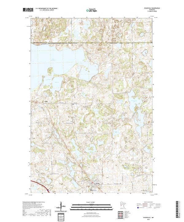
Evansville and the smaller settlement of Melby occupy a landscape defined by glacial depressions and significant water bodies along the border of Otter Tail and Douglas Counties. The region's transport history is visible in the alignment of the Central Lakes State Trail, which follows an older rail corridor through the heart of the township. Local heritage is anchored by sites like the Christina Lake Cem near the shores of Lake Ina and Lake Anka, while Mound Grove Memorial Park serves the community in the south. The abundance of water features, including the sprawling Lake Christina and the smaller Stockhousen Lake and Lake Sina, suggests a topography shaped by stagnant ice blocks, creating a complex patchwork of wetlands and prairie that has supported both agriculture and recreation for generations.
Find a feature on this map
67 named features on this map. Tap any name to fly to it.
Don’t see what you’re looking for? This feature index may not catch every label — zoom into the map to look around manually.
Map Details
Editions of this 2022 Evansville Map
This is the sole edition of this map. No revisions or reprints were ever made.