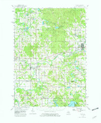
1959 Map of Evart
USGS Topo · Published 1982About this map
Evart and the surrounding township lands of Osceola and Evart dominate this 1950s landscape, where the Muskegon River and the Chesapeake and Ohio railway shaped local commerce. The map records a dense network of rural community centers, from the Stambaugh Corner settlement to the Hartwick Lookout Tower standing watch over the northern forests. Genealogists can identify numerous family-linked landmarks, including the Robinson Sch and several country houses of worship such as Bethel Ch and the West Grant Ch. The presence of Oil Wells and Gas Wells near Decker Ponds indicates the mid-century energy production that coexisted with the timbered tracts of the State Forest. From the clustered streets of Reed City to the smaller hamlets of Hersey and Grant Center, this survey captures the transition between industrial resource extraction and established rural life.
Find a feature on this map
125 named features on this map. Tap any name to fly to it.
Don’t see what you’re looking for? This feature index may not catch every label — zoom into the map to look around manually.
Map Details
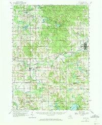
Editions of this 1959 Evart Map
3 editions found

Other maps of this area

1931 · Chase NE
USGS Topo · 1:31,680

1933 · Luther SE
USGS Topo · 1:31,680

1954 · Traverse City
USGS Topo · 1:250,000

1954 · Midland
USGS Topo · 1:250,000

1957 · Cadillac South
USGS Topo · 1:62,500

1957 · Luther
USGS Topo · 1:62,500

1957 · Marion
USGS Topo · 1:62,500

1958 · Traverse City
USGS Topo · 1:250,000

1958 · Midland
USGS Topo · 1:250,000

1958 · Woodville
USGS Topo · 1:62,500