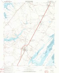
1968 Map of Exmore
USGS Topo · Published 1972About this map
Exmore serves as a primary hub for commerce and transport in this coastal landscape of Virginia's Eastern Shore, situated along the Penn Central rail line. The settlement pattern reflects a deeply rooted agricultural and maritime economy, evidenced by the Virginia Truck Experimental Station and the specialized docks at Willis Wharf. The railroad corridor facilitates a string of small communities and crossings such as Belle Haven Station and Coal Kiln Crossing, which provided essential links for moving produce and timber to larger markets.
Find a feature on this map
60 named features on this map. Tap any name to fly to it.
Don’t see what you’re looking for? This feature index may not catch every label — zoom into the map to look around manually.
Map Details
Editions of this 1968 Exmore Map
4 editions found
Other maps of this area

1931 · Accomac
USGS Topo · 1:48,000

1935 · Accomac
USGS Topo · 1:62,500

1941 · Broadwater
USGS Topo · 1:62,500

1942 · Nandua Creek
USGS Topo · 1:24,000

1942 · Little Machipongo Inlet
USGS Topo · 1:24,000

1942 · Nassawadox
USGS Topo · 1:24,000

1943 · Nassawadox
USGS Topo · 1:31,680

1943 · Jamesville
USGS Topo · 1:31,680

1943 · Pungoteague
USGS Topo · 1:31,680

1943 · Franktown
USGS Topo · 1:31,680