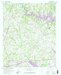
1958 Map of Fair Play
USGS Topo · Published 1979About this map
The boundary between Oconee Co Anderson Co centers this study of the Upstate landscape during the mid-to-late 20th century. The creation of Hartwell Lake is a defining physical change, shown here with inundated areas that transformed the valleys of Coneross Creek and Beaverdam Creek. The settlement of Fair Play sits near a major Interchange, while Townville remains a focal point on the eastern side of the county line.
Find a feature on this map
27 named features on this map. Tap any name to fly to it.
Don’t see what you’re looking for? This feature index may not catch every label — zoom into the map to look around manually.
Map Details
Editions of this 1958 Fair Play Map
4 editions found

Other maps of this area

1886 · Walhalla
USGS Topo · 1:125,000

1888 · Pickens
USGS Topo · 1:125,000

1891 · Carnesville
USGS Topo · 1:125,000

1892 · Walhalla
USGS Topo · 1:125,000

1893 · Elberton
USGS Topo · 1:125,000

1894 · Pickens
USGS Topo · 1:125,000

1896 · Walhalla
USGS Topo · 1:125,000

1950 · La France
USGS Topo · 1:24,000

1951 · La France
USGS Topo · 1:24,000

1951 · Clemson
USGS Topo · 1:24,000