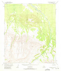
1949 Map of Fairbanks A-2
USGS Topo · Published 1972About this map
Japan Hills anchor this interior Alaskan landscape, surveyed in the mid-twentieth century when the region remained largely unsurveyed by ground crews. The topography, mapped via aerial photography, reveals a wilderness defined by the winding Wood River and its numerous tributaries like Bonnifield Creek and Gold King Creek. Human presence is exceptionally sparse, marked only by isolated features such as a lone Cabin and infrastructure supporting early aviation and communication, including a Landing Strip and a Radio Tower.
Find a feature on this map
18 named features on this map. Tap any name to fly to it.
Don’t see what you’re looking for? This feature index may not catch every label — zoom into the map to look around manually.
Map Details
Editions of this 1949 Fairbanks A-2 Map
3 editions found
Other maps of this area

1949 · Fairbanks B-3
USGS Topo · 1:63,360

1949 · Fairbanks A-2
USGS Topo · 1:63,360

1949 · Fairbanks A-1
USGS Topo · 1:63,360

1949 · Healy D-1
USGS Topo · 1:63,360

1950 · Fairbanks
USGS Topo · 1:250,000

1950 · Fairbanks A-3
USGS Topo · 1:63,360

1950 · Fairbanks B-2
USGS Topo · 1:63,360

1950 · Fairbanks B-1
USGS Topo · 1:63,360

1950 · Healy D-3
USGS Topo · 1:63,360

1951 · Healy
USGS Topo · 1:250,000