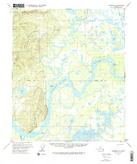
1952 Map of Fairbanks D-6
USGS Topo · Published 1972About this map
The Tanana River and Tolovana River converge in this interior landscape, defining a network of sloughs and crossings essential to early Alaskan travel. The topography is dominated by the Dugan Hills to the west, while the eastern lowlands are characterized by numerous wetlands like Grassy Lake and the meandering Swanneck Slough. The presence of Tolovana, Mc Kinley Crossing, and Upper Mc Kinley Crossing indicates the historical importance of river-based transport and seasonal routes.
Find a feature on this map
15 named features on this map. Tap any name to fly to it.
Don’t see what you’re looking for? This feature index may not catch every label — zoom into the map to look around manually.
Map Details
Editions of this 1952 Fairbanks D-6 Map
2 editions found
Other maps of this area

1945 · Livengood
USGS Topo · 1:250,000

1948 · Kantishna River
USGS Topo · 1:250,000

1950 · Fairbanks
USGS Topo · 1:250,000

1950 · Fairbanks C-5
USGS Topo · 1:63,360

1950 · Fairbanks D-5
USGS Topo · 1:63,360

1951 · Kantishna River
USGS Topo · 1:250,000

1951 · Fairbanks
USGS Topo · 1:250,000

1951 · Tanana
USGS Topo · 1:250,000

1951 · Livengood
USGS Topo · 1:250,000

1951 · Livengood A-5
USGS Topo · 1:63,360