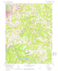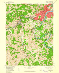
1958 Map of Fairmont West
USGS Topo · Published 1960About this map
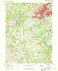
The Monongahela River serves as the focal point for this mid-century survey of Fairmont, where the confluence of the West Fork River and Tygart Valley River shapes the urban landscape. The city’s postwar institutional and industrial footprint is visible through the expansion of neighborhoods like Beverly Hills and Garden Village, alongside the campus of the State Teachers College. To the west, the topography is dotted with the small-scale operations of a coal-rich region, including numerous mines and strip mines located near Monongah and Killarm.
Find a feature on this map
95 named features on this map. Tap any name to fly to it.
Don’t see what you’re looking for? This feature index may not catch every label — zoom into the map to look around manually.
Map Details
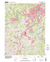
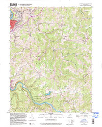
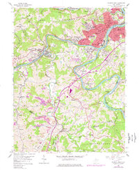
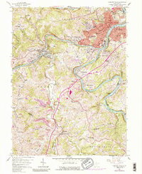
Editions of this 1958 Fairmont West Map
4 editions found
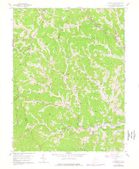
Historical Maps of Bellview Through Time
8 maps found