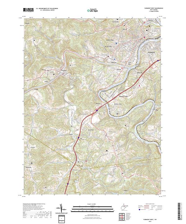
2023 Map of Fairmont West
USGS Topo · Published 2023About this map
Fairmont serves as the focal point of this survey, situated where the West Fork River and Tygart Valley River converge to form the Monongahela River. The landscape is a dense network of neighborhoods and former industrial sites, including Gaston Junction, Millersville, and the hillside campus of Fairmont State University. Further south, the town of Monongah sits along the west bank of the river, near the Mount Calvary Cem and Cochran Cem.
Find a feature on this map
95 named features on this map. Tap any name to fly to it.
Don’t see what you’re looking for? This feature index may not catch every label — zoom into the map to look around manually.
Map Details
Editions of this 2023 Fairmont West Map
This is the sole edition of this map. No revisions or reprints were ever made.
Other maps of this area

1902 · Clarksburg
USGS Topo · 1:62,500

1902 · Fairmont
USGS Topo · 1:62,500

1904 · Blacksville
USGS Topo · 1:62,500

1905 · Mannington
USGS Topo · 1:62,500

1910 · Clarksburg
USGS Topo · 1:62,500

1923 · Blacksville
USGS Topo · 1:62,500

1923 · Fairmont
USGS Topo · 1:62,500

1923 · Mannington
USGS Topo · 1:62,500

1923 · Clarksburg
USGS Topo · 1:62,500

1925 · Blacksville
USGS Topo · 1:62,500