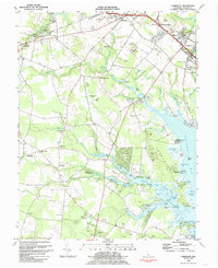
1984 Map of Fairmount
USGS Topo · Published 1985About this map
The marshy lowlands and tidal inlets of eastern Sussex County are meticulously detailed in this early 1980s survey. The landscape is defined by the winding course of Love Creek and its many branches, including Stillman Glade and Hetty Fisher Glade, which feed into the northern reaches of Rehoboth Bay. This era shows a transition in land use, where traditional rural settlements like Angola, Hollyville, and Jimtown are interspersed with several large Trailer Parks and campgrounds, reflecting the region's growing role as a coastal destination.
Find a feature on this map
95 named features on this map. Tap any name to fly to it.
Don’t see what you’re looking for? This feature index may not catch every label — zoom into the map to look around manually.
Map Details
Editions of this 1984 Fairmount Map
3 editions found
Other maps of this area

1917 · Millsboro
USGS Topo · 1:62,500

1918 · Cedar Creek
USGS Topo · 1:62,500

1918 · Rehoboth
USGS Topo · 1:62,500

1918 · Cape Henlopen
USGS Topo · 1:62,500

1919 · Cedar Creek
USGS Topo · 1:62,500

1937 · Cape Henlopen
USGS Topo · 1:62,500

1938 · Cedar Creek
USGS Topo · 1:62,500

1938 · Millsboro
USGS Topo · 1:62,500

1938 · Rehoboth
USGS Topo · 1:62,500

1943 · Fairmount
USGS Topo · 1:24,000
Featured Places
- Angola Crest Mobile Home Park, DE
- Angola Landing, DE
- Cool Spring, DE
- William Ritter Manor, DE
- Mallard Point, DE