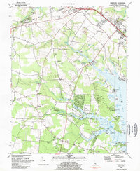
1984 Map of Fairmount
USGS Topo · Published 1984About this map
The coastal plains of Sussex County are defined here by the intricate network of tidal creeks and inlets feeding into Rehoboth Bay. This mid-1980s survey captures a landscape of inland settlements like Jimtown, Belltown, and Hollyville, many of which grew around rural social centers like the Indian Mission Ch and St Georges Chapel. The local economy of the era is visible through the Delaware Coast Line railroad and numerous sandpits, while the shoreline is dotted with historic landings such as Webb Landing, Fisher Landing, and Robinson Landing.
Find a feature on this map
92 named features on this map. Tap any name to fly to it.
Don’t see what you’re looking for? This feature index may not catch every label — zoom into the map to look around manually.
Map Details
Editions of this 1984 Fairmount Map
3 editions found
Other maps of this area

1917 · Millsboro
USGS Topo · 1:62,500

1918 · Cedar Creek
USGS Topo · 1:62,500

1918 · Rehoboth
USGS Topo · 1:62,500

1918 · Cape Henlopen
USGS Topo · 1:62,500

1919 · Cedar Creek
USGS Topo · 1:62,500

1937 · Cape Henlopen
USGS Topo · 1:62,500

1938 · Cedar Creek
USGS Topo · 1:62,500

1938 · Millsboro
USGS Topo · 1:62,500

1938 · Rehoboth
USGS Topo · 1:62,500

1943 · Fairmount
USGS Topo · 1:24,000
Featured Places
- Angola Crest Mobile Home Park, DE
- Angola Landing, DE
- Cool Spring, DE
- William Ritter Manor, DE
- Mallard Point, DE