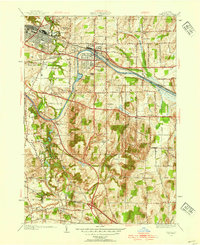
1952 Map of Fairport
USGS Topo · Published 1954About this map
The Erie Canal cuts a distinctive path through the heart of Monroe County in the early 1950s, serving as the historical and industrial anchor for Fairport and East Rochester. This period shows a landscape in transition, where established village grids meet the expanding suburbs and preserved recreational spaces like Powder Mill Park and the White Haven Memorial Park Cemetery. The presence of three major rail lines—the New York Central RR, West Shore RR, and Lehigh Valley RR—highlights the area's role as a critical transportation corridor.
Find a feature on this map
67 named features on this map. Tap any name to fly to it.
Don’t see what you’re looking for? This feature index may not catch every label — zoom into the map to look around manually.
Map Details
Editions of this 1952 Fairport Map
4 editions found
Other maps of this area

1895 · Rochester
USGS Topo · 1:62,500

1898 · Rochester
USGS Topo · 1:62,500

1900 · Macedon
USGS Topo · 1:62,500

1900 · Canandaigua
USGS Topo · 1:62,500

1901 · Honeoye
USGS Topo · 1:62,500

1903 · Canandaigua
USGS Topo · 1:62,500

1904 · Honeoye
USGS Topo · 1:62,500

1912 · Rochester
USGS Topo · 1:62,500

1920 · Rochester
USGS Topo · 1:62,500

1931 · Mendon Ponds
USGS Topo · 1:24,000