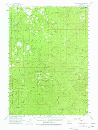
1955 Map of Fairview Peak
USGS Topo · Published 1978About this map
The high ridges of the Willamette Calapoya Divide define this mid-1950s survey of the western Cascades along the boundary of Lane and Douglas counties. The landscape is dominated by the legacy of the Bohemia Mining District, where the Champion Mine, Musick Mine, Noonday Mine, and Helena Mine are clustered near the summit of Fairview Peak. These sites, connected by rugged routes like the Champion Creek Road, represent a significant era of extraction and forest management within the Willamette National Forest and Umpqua National Forest.
Find a feature on this map
114 named features on this map. Tap any name to fly to it.
Don’t see what you’re looking for? This feature index may not catch every label — zoom into the map to look around manually.
Map Details
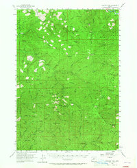
Editions of this 1955 Fairview Peak Map
3 editions found
Other maps of this area

1917 · Diamond Lake
USGS Topo · 1:125,000

1925 · Waldo Lake
USGS Topo · 1:125,000

1935 · Lowell
USGS Topo · 1:96,000

1942 · Lowell
USGS Topo · 1:125,000

1955 · Hardesty Mtn
USGS Topo · 1:62,500

1955 · Mace Mtn
USGS Topo · 1:62,500

1955 · Illahee Rock
USGS Topo · 1:62,500

1955 · Fairview Peak
USGS Topo · 1:62,500

1955 · Culp Creek
USGS Topo · 1:62,500

1955 · Lowell
USGS Topo · 1:62,500