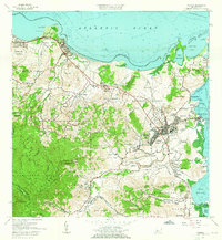
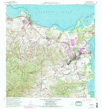
1962 Map of Fajardo
USGS Topo · Published 1965About this map
The coastal city of Fajardo serves as the focal point of this 1962 survey, revealing the urban layout of its four central districts: Pueblo Norte, Pueblo Sur, Pueblo Este, and Pueblo Oeste. At the edge of the Sonda de Vieques, the active maritime character of Puerto Real and the Bahia de Fajardo contrast with the nearby Roosevelt Roads Naval Reservation to the south.
Find a feature on this map
102 named features on this map. Tap any name to fly to it.
Don’t see what you’re looking for? This feature index may not catch every label — zoom into the map to look around manually.
Map Details
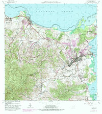
Editions of this 1962 Fajardo Map
6 editions found
Other maps of this area

1941 · Rio Grande
USGS Topo · 1:30,000

1945 · Cayo Icacos
USGS Topo · 1:30,000

1945 · El Yunque
USGS Topo · 1:30,000

1946 · El Yunque
USGS Topo · 1:30,000

1946 · Punta Puerca
USGS Topo · 1:30,000

1946 · Naguabo
USGS Topo · 1:30,000

1946 · Fajardo
USGS Topo · 1:30,000

1947 · El Yunque NE
USGS Topo · 1:10,000

1947 · Rio Grande
USGS Topo · 1:30,000

1947 · El Yunque SE
USGS Topo · 1:10,000