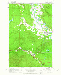
1953 Map of Fall City
USGS Topo · Published 1963About this map
The Snoqualmie River meanders through the valley at the center of this 1953 survey, defining a landscape of agriculture and small settlements between the highlands of Grand Ridge and West Tiger Mtn. The town of Fall City serves as a focal point near the confluence of the river and Raging River, supported by the Chicago Milwaukee St Paul and Pacific rail line. To the south, the timber and mining geography is evident near Preston and Upper Preston, where the Northern Pacific tracks follow the corridor of East Fk Issaquah Creek. Local industry is represented by the Reynolds Mine and several prospects on Mitchell Hill, while the Fall City Cemetery and various gaging stations along the river provide specific points of interest for genealogists and hydrologists studying the mid-century development of King County.
Find a feature on this map
41 named features on this map. Tap any name to fly to it.
Don’t see what you’re looking for? This feature index may not catch every label — zoom into the map to look around manually.
Map Details
Editions of this 1953 Fall City Map
5 editions found

Other maps of this area

1895 · Snohomish
USGS Topo · 1:125,000

1897 · Tacoma
USGS Topo · 1:125,000

1897 · Seattle
USGS Topo · 1:125,000

1900 · Tacoma
USGS Topo · 1:125,000

1913 · Cedar Lake
USGS Topo · 1:125,000

1921 · Sultan
USGS Topo · 1:125,000

1923 · Sultan
USGS Topo · 1:125,000

1949 · Maple Valley
USGS Topo · 1:24,000

1950 · Redmond
USGS Topo · 1:24,000

1950 · Issaquah
USGS Topo · 1:24,000