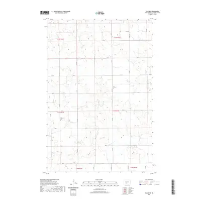
2020 Map of Fallon NE
USGS Topo · Published 2020About this map
The Little Heart River meanders through the rolling terrain of Morton County, marking the primary drainage for this agricultural landscape. The township boundaries of t137n r83w and t137n r82w intersect in a region defined by a precise section-line road network, including arterial routes like Co Rd 83 and Co Hwy 138. Two significant burial grounds, the Stone Lutheran Cem and Rural Union Cem, serve as enduring landmarks of the area's pioneer heritage and local genealogy. The spatial distribution of these features reflects the organized settlement patterns typical of the North Dakota prairie, where small rural congregations and cemeteries remained the focal points for dispersed farming communities even as transportation routes modernized.
Find a feature on this map
31 named features on this map. Tap any name to fly to it.
Don’t see what you’re looking for? This feature index may not catch every label — zoom into the map to look around manually.
Map Details
Editions of this 2020 Fallon NE Map
This is the sole edition of this map. No revisions or reprints were ever made.
Other maps of this area

1907 · Bismarck
USGS Topo · 1:125,000

1951 · Bismarck
USGS Topo · 1:62,500

1951 · Mandan
USGS Topo · 1:24,000

1954 · Bismarck
USGS Topo · 1:250,000

1958 · Bismarck
USGS Topo · 1:250,000

1962 · Mandan
USGS Topo · 1:24,000

1972 · Sweet Briar
USGS Topo · 1:24,000

1972 · Crown Butte Lake
USGS Topo · 1:24,000

1979 · Bismarck
USGS Topo · 1:100,000

1980 · Fallon NE
USGS Topo · 1:24,000