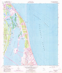
1949 Map of False Cape
USGS Topo · Published 1971About this map
John F Kennedy Space Center (NASA) dominates this coastal Florida landscape, capturing the rapid transformation of the Atlantic shoreline into a global hub for space exploration. While the base topography and hydrography were established in 1949, significant purple revisions from 1970 illustrate the massive infrastructure of the space race, including Launch Complex 39A and Launch Complex 39B. The map documents a unique tension between the industrial scale of the Cape Kennedy Air Force Station and the intricate coastal ecosystems of the Banana River and Merritt Island.
Find a feature on this map
42 named features on this map. Tap any name to fly to it.
Don’t see what you’re looking for? This feature index may not catch every label — zoom into the map to look around manually.
Map Details
Editions of this 1949 False Cape Map
3 editions found
Other maps of this area

1949 · Orsino
USGS Topo · 1:24,000

1949 · False Cape
USGS Topo · 1:24,000

1949 · Courtenay
USGS Topo · 1:24,000

1949 · Wilson
USGS Topo · 1:24,000

1951 · False Cape
USGS Topo · 1:24,000

1951 · Courtenay
USGS Topo · 1:24,000

1951 · Orsino
USGS Topo · 1:24,000
1951 · Cape Canaveral
USGS Topo · 1:24,000

1952 · Wilson
USGS Topo · 1:24,000

1955 · Orlando
USGS Topo · 1:250,000