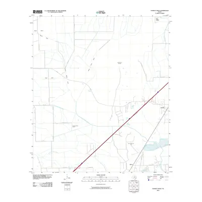
2010 Map of Fannett West
USGS Topo · Published 2010About this map
Jefferson County's coastal prairie landscape is defined here by the intricate drainage systems of the North Fork Taylor Bayou and South Fork Taylor Bayou. In the early 21st century, this region south of China illustrates the enduring connection between agricultural land use and the energy industry. The Gilbert Ranch Oil Field and Marrs Mclean Gas Field are prominent features, interspersed with rural settlements like Morey and Fannett. A network of ranch roads, including Deaton Ranch Rd and Heisig Rd, provides access to private estates and the Broussard Farm Airport. The map also reveals localized terrain features like Pignut Island and Green Pond Gully, which speak to the subtle elevation changes and hydrology characteristic of the Texas Gulf Coast plain.
Find a feature on this map
29 named features on this map. Tap any name to fly to it.
Don’t see what you’re looking for? This feature index may not catch every label — zoom into the map to look around manually.
Map Details
Editions of this 2010 Fannett West Map
This is the sole edition of this map. No revisions or reprints were ever made.
Other maps of this area

1932 · Beaumont
USGS Topo · 1:62,500

1943 · Stowell
USGS Topo · 1:24,000

1943 · Fannett East
USGS Topo · 1:24,000

1945 · Fannett East
USGS Topo · 1:31,680

1945 · Nolte
USGS Topo · 1:31,680

1950 · Houston
USGS Topo · 1:250,000

1954 · Beaumont
USGS Topo · 1:250,000

1955 · Sour Lake
USGS Topo · 1:62,500

1956 · Houston
USGS Topo · 1:250,000

1957 · Beaumont
USGS Topo · 1:250,000