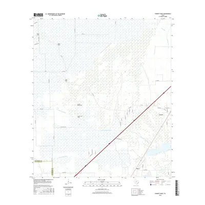
2016 Map of Fannett West
USGS Topo · Published 2016About this map
Fannett and Morey anchor this coastal Texas landscape, where the flat coastal prairie meets a complex network of wetlands and drainage. The terrain is defined by its subtle hydrology, with the North Fork Taylor Bayou and S Fork Taylor Bayou snaking across the lowlands alongside numerous gullies like Pignut Gully and Vogel Gully. The map illustrates a transitional rural environment where larger tracts of open land are increasingly bisected by a growing grid of roads such as Deaton Ranch Rd and Hamshire Rd. At the northern edge, Bayou Din and the Gallier Canal indicate the importance of managed water systems in this region near the Jefferson and Chambers County line. Notable landmarks such as Pignut Island stand out as distinct natural features amidst the expansive marshy reaches of the Southeast Texas coast.
Find a feature on this map
46 named features on this map. Tap any name to fly to it.
Don’t see what you’re looking for? This feature index may not catch every label — zoom into the map to look around manually.
Map Details
Editions of this 2016 Fannett West Map
This is the sole edition of this map. No revisions or reprints were ever made.
Other maps of this area

1932 · Beaumont
USGS Topo · 1:62,500

1943 · Stowell
USGS Topo · 1:24,000

1943 · Fannett East
USGS Topo · 1:24,000

1945 · Fannett East
USGS Topo · 1:31,680

1945 · Nolte
USGS Topo · 1:31,680

1950 · Houston
USGS Topo · 1:250,000

1954 · Beaumont
USGS Topo · 1:250,000

1955 · Sour Lake
USGS Topo · 1:62,500

1956 · Houston
USGS Topo · 1:250,000

1957 · Beaumont
USGS Topo · 1:250,000