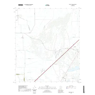
2019 Map of Fannett West
USGS Topo · Published 2019About this map
North Fork Taylor Bayou and its southern fork dominate this low-lying coastal prairie landscape at the border of Jefferson and Chambers Counties. The map reveals a transition from the agricultural expanses and complex drainage gullies of the west to the growing residential footprints in Fannett and the smaller settlement of Morey. A intricate network of water management features, including the Gallier Canal and several named gullies like Green Pond Gully and Ground Bridge Gully, underscores the region's reliance on precise drainage. Local land use is reflected in family-named routes and ranch markers such as Deaton Ranch Rd and McDermand Rd, while the distinctive Pignut Island provides a notable landmark amidst the prairie's slow-moving waterways.
Find a feature on this map
46 named features on this map. Tap any name to fly to it.
Don’t see what you’re looking for? This feature index may not catch every label — zoom into the map to look around manually.
Map Details
Editions of this 2019 Fannett West Map
This is the sole edition of this map. No revisions or reprints were ever made.
Other maps of this area

1932 · Beaumont
USGS Topo · 1:62,500

1943 · Stowell
USGS Topo · 1:24,000

1943 · Fannett East
USGS Topo · 1:24,000

1945 · Fannett East
USGS Topo · 1:31,680

1945 · Nolte
USGS Topo · 1:31,680

1950 · Houston
USGS Topo · 1:250,000

1954 · Beaumont
USGS Topo · 1:250,000

1955 · Sour Lake
USGS Topo · 1:62,500

1956 · Houston
USGS Topo · 1:250,000

1957 · Beaumont
USGS Topo · 1:250,000