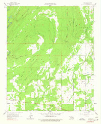
1957 Map of Farris
USGS Topo · Published 1977About this map
Farris and the surrounding timberlands of the Oklahoma hill country are detailed here in a 1950s survey that remained largely unchanged into the late 1970s. The landscape is defined by a dense network of creek drainages, including McGee Creek and the twisting path of Tenmile Creek. Small rural social centers are anchored by local institutions like Pine Springs School, Center Point Church, and the Farris School, reflecting the scattered settlement patterns of Atoka and Pushmataha Counties. The rugged topography is dominated by prominent elevations such as Long Mountain and Sugarloaf Hill, which overlook a maze of hollows like Cat Hollow and Grassy Hollow. This map documents a quiet period in the region's history, capturing the location of family cemeteries and church sites before later land-use changes or modern development altered the rural character of these isolated communities.
Find a feature on this map
41 named features on this map. Tap any name to fly to it.
Don’t see what you’re looking for? This feature index may not catch every label — zoom into the map to look around manually.
Map Details
Editions of this 1957 Farris Map
3 editions found
Other maps of this area

1901 · Antlers
USGS Topo · 1:125,000

1912 · Antlers
USGS Topo · 1:125,000

1925 · Antlers
USGS Topo · 1:125,000

1950 · Mcalester
USGS Topo · 1:250,000

1957 · Lane NW
USGS Topo · 1:24,000

1957 · Farris
USGS Topo · 1:24,000

1957 · Moyers
USGS Topo · 1:24,000

1957 · Jumbo
USGS Topo · 1:24,000

1957 · Lane
USGS Topo · 1:24,000

1957 · Lane NE
USGS Topo · 1:24,000