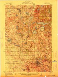
1913 Map of Fergus Falls
USGS Topo · Published 1913About this map
The Otter Tail River and the Pelican River converge in the southern portion of this region, fueling the growth of Fergus Falls during the pre-war era. This 1911 survey details a dense network of rural infrastructure, including a dozen numbered schoolhouses and the massive State Insane Asylum complex just outside the city center. The landscape is defined by its post-glacial hydrology, with dozens of named water bodies like Lake Jewett, Lake Oscar, and Long Lake interspersed among the townships of Erhards Grove, Elizabeth, and Carlisle.
Find a feature on this map
64 named features on this map. Tap any name to fly to it.
Don’t see what you’re looking for? This feature index may not catch every label — zoom into the map to look around manually.
Map Details
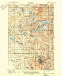
Editions of this 1913 Fergus Falls Map
3 editions found
Other maps of this area

1910 · Wendell
USGS Topo · 1:62,500

1912 · Vergas
USGS Topo · 1:62,500

1913 · Ashby
USGS Topo · 1:62,500

1913 · Fergus Falls
USGS Topo · 1:62,500

1913 · Wendell
USGS Topo · 1:62,500

1914 · Pelican Rapids
USGS Topo · 1:62,500

1915 · Underwood
USGS Topo · 1:62,500

1915 · Vergas
USGS Topo · 1:62,500

1917 · Pelican Rapids
USGS Topo · 1:62,500

1919 · Rothsay
USGS Topo · 1:62,500