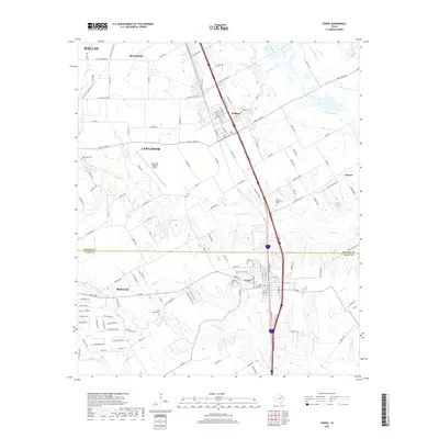
2019 Map of Ferris
USGS Topo · Published 2019About this map
Ferris and Wilmer anchor this landscape along the Dallas and Ellis county line, where the suburban reaches of Dallas meet the agricultural fields of north Texas. The area is defined by its transit corridors and water systems, with the Trinity River and Gravel Slough forming the eastern boundary of the quadrangle. Local aviation is centered at the Lancaster Regional Airport, while the region's long-term settlement history is preserved in numerous burial grounds, including Trinity Cem and the Old Cem near the heart of Ferris. Several waterways like Tenmile Cr and Bear Cr branch across the terrain, flowing toward the Trinity basin. This modern survey captures the distinct transition between the expanding municipal footprints of Hutchins and Lancaster and the traditional creek-side lands of the Red Oak area.
Find a feature on this map
100 named features on this map. Tap any name to fly to it.
Don’t see what you’re looking for? This feature index may not catch every label — zoom into the map to look around manually.
Map Details
Editions of this 2019 Ferris Map
This is the sole edition of this map. No revisions or reprints were ever made.
Other maps of this area

1891 · Dallas
USGS Topo · 1:125,000

1893 · Dallas
USGS Topo · 1:125,000

1954 · Dallas
USGS Topo · 1:250,000

1956 · Ennis
USGS Topo · 1:62,500

1958 · Dallas
USGS Topo · 1:250,000

1958 · Hutchins
USGS Topo · 1:24,000

1958 · Oak Cliff
USGS Topo · 1:24,000

1959 · Lancaster
USGS Topo · 1:24,000

1959 · Seagoville
USGS Topo · 1:24,000

1959 · Ferris
USGS Topo · 1:24,000