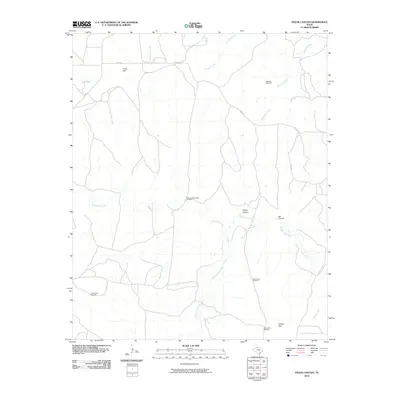
2010 Map of Fields Canyon
USGS Topo · Published 2010About this map
The Middle Pease River carves through this West Texas landscape, where life is shaped by the search for water in a semi-arid terrain. Scattered windmills, including the Richland Windmill, Mouth of Turtle Hole Windmill, and New Corral Windmill, testify to the vital necessity of groundwater for ranching operations in Cottle County. The terrain is defined by broad flats and rugged breaks, with Leary Flat to the north and Cooper Flat to the south. Notable geological features like Fields Canyon and Bar Canyon offer a look at the erosive power of seasonal waterways like Turtle Hole Creek and Richland Creek. While the area is largely uninhabited except for ranch infrastructure, the presence of Gyp Tank and various county roads, such as Co RD 240, suggests a landscape used primarily for grazing and cattle management in the early 21st century.
Find a feature on this map
21 named features on this map. Tap any name to fly to it.
Don’t see what you’re looking for? This feature index may not catch every label — zoom into the map to look around manually.
Map Details
Editions of this 2010 Fields Canyon Map
This is the sole edition of this map. No revisions or reprints were ever made.
Other maps of this area

1954 · Plainview
USGS Topo · 1:250,000

1958 · Plainview
USGS Topo · 1:250,000

1966 · Fields Canyon
USGS Topo · 1:24,000

1966 · Ballard Camp
USGS Topo · 1:24,000

1966 · Cee Vee
USGS Topo · 1:24,000

1966 · Tee Pee City
USGS Topo · 1:24,000

1966 · Devils Canyon
USGS Topo · 1:24,000

1967 · Tell South
USGS Topo · 1:24,000

1967 · Cottonwood Camp
USGS Topo · 1:24,000

1967 · Turtle Hole Camp
USGS Topo · 1:24,000