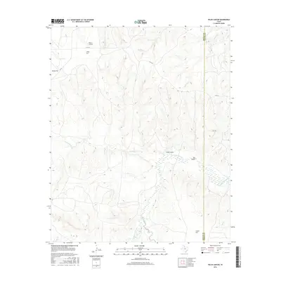
2016 Map of Fields Canyon
USGS Topo · Published 2016About this map
The Middle Pease River carves through the landscape along the western edge of Cottle County, defining a complex topography of breaks and flats in this 2016 survey. This area of the Texas Rolling Plains is characterized by expansive plateaus like Baines Flat and Cooper Flat, separated by the deep incisions of Fields Canyon and Bar Canyon. The map reveals a legacy of ranching and early settlement through named locations such as Ballard Camp, Tee Pee City, and Turtle Hole Camp. Seasonal watercourses, including Turtle Hole Cr and Richland Cr, feed into the river system, while infrastructure is primarily limited to rural routes like FM 94 and various county roads. The interface between Motley and Cottle Counties runs along the eastern portion of the sheet, marking a remote frontier where the terrain shifts from the high flats of Leary Flat down into the rugged drainage of Joe Lake Cr.
Find a feature on this map
26 named features on this map. Tap any name to fly to it.
Don’t see what you’re looking for? This feature index may not catch every label — zoom into the map to look around manually.
Map Details
Editions of this 2016 Fields Canyon Map
This is the sole edition of this map. No revisions or reprints were ever made.
Other maps of this area

1954 · Plainview
USGS Topo · 1:250,000

1958 · Plainview
USGS Topo · 1:250,000

1966 · Fields Canyon
USGS Topo · 1:24,000

1966 · Ballard Camp
USGS Topo · 1:24,000

1966 · Cee Vee
USGS Topo · 1:24,000

1966 · Tee Pee City
USGS Topo · 1:24,000

1966 · Devils Canyon
USGS Topo · 1:24,000

1967 · Tell South
USGS Topo · 1:24,000

1967 · Cottonwood Camp
USGS Topo · 1:24,000

1967 · Turtle Hole Camp
USGS Topo · 1:24,000