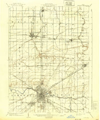
1903 Map of Findlay
USGS Topo · Published 1939About this map
Findlay serves as the central hub of this turn-of-the-century landscape, positioned where the Blanchard River meets a dense concentration of rail lines. The map reveals a region defined by its industrial and agricultural infrastructure, particularly the prominent grid of the Cincinnati Hamilton and Dayton R. R. and the Baltimore and Ohio R. R. crossing at North Baltimore. This era in Wood and Hancock counties was marked by the oil boom, reflected in place names like Oil Center and the presence of numerous small settlements and junctions like Galatea and Mortimer. North of the city, the landscape is drained by a network of waterways including Rocky Ford and Bull Creek, while the southeastern corner is defined by the marshy lowland known as The Outlet. The transition from small villages like Bairdstown to the growing urban center of Findlay captures Northwest Ohio at a peak of rail-driven expansion.
Find a feature on this map
46 named features on this map. Tap any name to fly to it.
Don’t see what you’re looking for? This feature index may not catch every label — zoom into the map to look around manually.
Map Details
Editions of this 1903 Findlay Map
2 editions found
Other maps of this area

1901 · Fostoria
USGS Topo · 1:62,500

1901 · Bowling Green
USGS Topo · 1:62,500

1901 · Elmore
USGS Topo · 1:62,500

1903 · Bowling Green
USGS Topo · 1:62,500

1903 · Fostoria
USGS Topo · 1:62,500

1903 · Findlay
USGS Topo · 1:62,500

1903 · Elmore
USGS Topo · 1:62,500

1905 · Arlington
USGS Topo · 1:62,500

1907 · Bluffton
USGS Topo · 1:62,500

1907 · Arlington
USGS Topo · 1:24,000