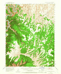
1953 Map of Firewater Canyon
USGS Topo · Published 1966About this map
Desolation Canyon and its dramatic serpentine meanders through the Green River dominate this 1950s survey of eastern Utah. The landscape is defined by the sharp transition between high plateaus and deep drainage systems, including the massive Uintah and Ouray Indian Reservation and the Uncompahgre Addition. Vital water sources such as Charlie Brown Spring, Secret Spring, and Bishop Spring indicate the essential points for survival and ranching in this arid environment. Significant landmarks like Peters Point and North Point provide orientation across the broken terrain of Firewater Canyon and Little Rock House Canyon. This edition illustrates the complex topography before more modern developments, preserving the nomenclature of isolated basins like Tabyago Basin and livestock-grazing reaches like Wolf Flat.
Find a feature on this map
42 named features on this map. Tap any name to fly to it.
Don’t see what you’re looking for? This feature index may not catch every label — zoom into the map to look around manually.
Map Details
Editions of this 1953 Firewater Canyon Map
3 editions found
Other maps of this area

1885 · East Tavaputs
USGS Topo · 1:250,000

1886 · Price River
USGS Topo · 1:250,000

1896 · Price River
USGS Topo · 1:250,000

1953 · Nutters Hole
USGS Topo · 1:62,500

1953 · Firewater Canyon
USGS Topo · 1:62,500

1954 · Flat Canyon
USGS Topo · 1:62,500

1954 · Range Creek
USGS Topo · 1:62,500

1956 · Price
USGS Topo · 1:250,000

1956 · Grand Junction
USGS Topo · 1:250,000

1959 · Grand Junction
USGS Topo · 1:250,000