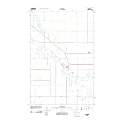
2010 Map of Fisher
USGS Topo · Published 2010About this map
The Red Lake River meanders sharply across the flat terrain of Polk County, defining the local geography around the settlement of Fisher. This 2010 survey shows the area's agricultural character, where a dense grid of county roads such as County Hwy-15 and County Hwy-60 provide access to dispersed farmsteads and small communities. The settlement of Fisher serves as the primary hub, containing the Fisher Post Office and connecting to the surrounding landscape via Demers Ave.
Find a feature on this map
23 named features on this map. Tap any name to fly to it.
Don’t see what you’re looking for? This feature index may not catch every label — zoom into the map to look around manually.
Map Details
Editions of this 2010 Fisher Map
This is the sole edition of this map. No revisions or reprints were ever made.
Other maps of this area

1919 · Eldred
USGS Topo · 1:62,500

1919 · Beltrami
USGS Topo · 1:62,500

1952 · Grand Forks
USGS Topo · 1:250,000

1953 · Crookston
USGS Topo · 1:62,500

1956 · Grand Forks
USGS Topo · 1:250,000
1963 · Mallory
USGS Topo · 1:24,000
1963 · Key West
USGS Topo · 1:24,000

1964 · Girard
USGS Topo · 1:24,000

1964 · Climax NW
USGS Topo · 1:24,000
1964 · Fisher
USGS Topo · 1:24,000