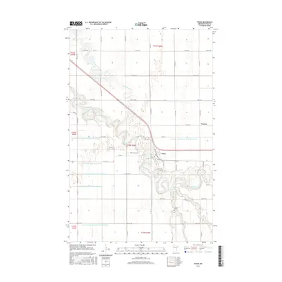
2016 Map of Fisher
USGS Topo · Published 2016About this map
The Red Lake River meanders across the landscape of Polk County, where the settlement of Fisher serves as a central hub. This survey illustrates a highly engineered agricultural environment, where natural waterways like Grand Marais Creek and Burnham Cr are supplemented by an extensive network of drainage infrastructure, including County Ditch Number One Hundred Twentythree and County Ditch Number One Hundred Thirtyfour. The landscape is organized by a rigid grid of section lines and gravel roads, reflecting the systematic land use of the Red River Valley.
Find a feature on this map
54 named features on this map. Tap any name to fly to it.
Don’t see what you’re looking for? This feature index may not catch every label — zoom into the map to look around manually.
Map Details
Editions of this 2016 Fisher Map
This is the sole edition of this map. No revisions or reprints were ever made.
Other maps of this area

1919 · Eldred
USGS Topo · 1:62,500

1919 · Beltrami
USGS Topo · 1:62,500

1952 · Grand Forks
USGS Topo · 1:250,000

1953 · Crookston
USGS Topo · 1:62,500

1956 · Grand Forks
USGS Topo · 1:250,000
1963 · Mallory
USGS Topo · 1:24,000
1963 · Key West
USGS Topo · 1:24,000

1964 · Girard
USGS Topo · 1:24,000

1964 · Climax NW
USGS Topo · 1:24,000
1964 · Fisher
USGS Topo · 1:24,000